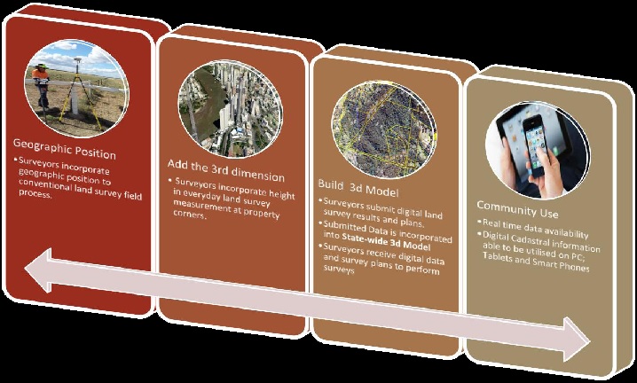
3dQLD will be a progressive change, and build upon the current land cadastre system. Most who do not have an intimate understanding of the surveying and mapping process may not even notice a change.
As 3dQLD builds and the volume of accurate three dimensional spatial data increases it will be possible to use 3dQLD data to correct or improve the limitations of the current Digital Cadastral Data Base (DCDB). This will coincide with increased public use of mapping and hence a greater reliance on the data produced by this reform. 3dQLD will become critical in adapting the current system to meet the future needs of the community.
For those who administer land, the effects of change will be incremental but significant to their everyday process. A greater utilisation of positional technology and digital data over traditional methodology will inevitably occur over time.
A digital conveyance platform for registration of interests in land will be supported by 3dQLD reforms.
3dQLD will not mean there will be any change in licensing or registration of land surveyors. Steps will be taken to assess competency amongst Registered Land Surveyors to meet the changes in technology and survey process.
3dQLD will aim to limit the reliance on government and encourage a collaborative private-public sector partnership in the future function and maintenance of the cadastral system.